CODES 320 Midterm Portfolio
Introduction
As we pass midterms I think my favorite aspect of this class so far has been working to create my first product. This product has given me the ability to combine the work I have done with NGRREC with my major, geography. I feel that maps and visuals are essential when attempting to present an argument regarding space and hope that through the use of my map communities can begin to fight harder for equitable access to greenspace.
Goal 1 Written Communication (20%)
I will use appropriate relevant and compelling language to clearly communicate with the class and Dr. Shea.
Reading Reflections
Currently, I think that my reading reflections are the best example of my use of written communication.
What Was Learned
- How to efficiently reflect on the past progress of my group
- How to interpret texts written in a less scholarly fashion
Goal 2 Collaboration (20%)
I will speak up in class and provide input when appropriate. I will also encourage classmates to collaborate by helping them engage. When working in groups, I will be an effective team member who can help our group move forward.
Meeting Notes For Group
When we were first in the planning stage for this class I decided to create meeting notes that my groupmates could reference if they were confused about the products we were considering making. Since I have yet to complete the product that will be most focused on collaboration I feel that this is the best example of my collaboration so far.
What Was Learned
- How to lead and target our group conversations.
- How to identify meeting highlights.
- How to efficiently communicate to group members the goals for the next meeting.
Goal 3 Research Development (20%)
I will prioritize using my research skills to form appropriate and workable solutions for our issues in class.
Map of Missouri and Illinois Greenspace (Census Tracts)
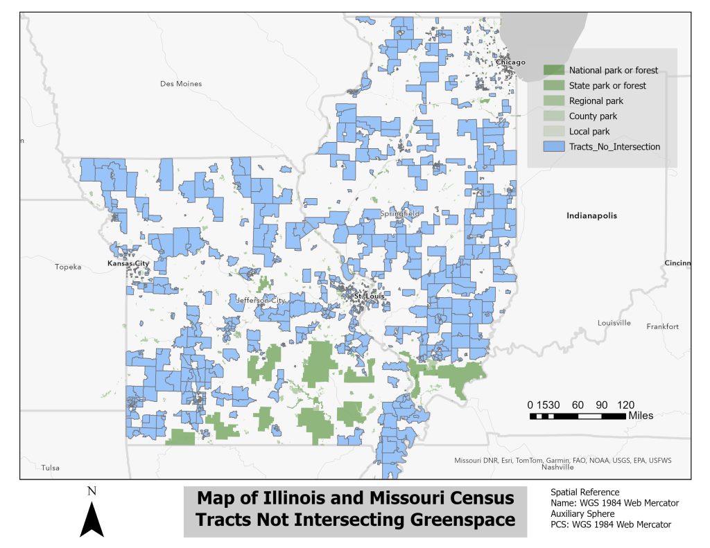
This map shows census tracts throughout Illinois and Missouri that fail to intersect with any of the listed greenspaces. While this greenspace map may not include everything throughout the states it was the most comprehensive map that I could find so far. All of the green-shaded items on the map are greenspaces and all the blue items are Census tracts as identified for the 2020 Census.
I think that this map and its continuation are perfect examples of my commitment to research development. Throughout the whole process of creating this map, I was consistently met with issues such as Census tracts not loading properly or being unable to find the data I wanted. However, through it all, I was able to adjust my project and continue making what I could.
What Was Learned
- How to effectively use visuals to identify areas of a community that lack physical access to green space
- How to problem solve in ARC GIS Pro
- How to identify physical intersections in ARC GIS Pro
- How to create a map layout in ARC GIS Pro
Goal 4 Informative Literacy/Research (20%)
I will effectively determine logical and effective research questions. I will use effective methods to answer said questions and identify multiple possible solutions for each question.
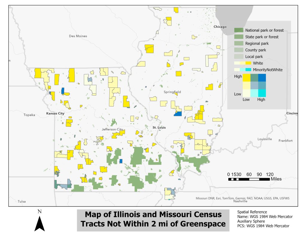
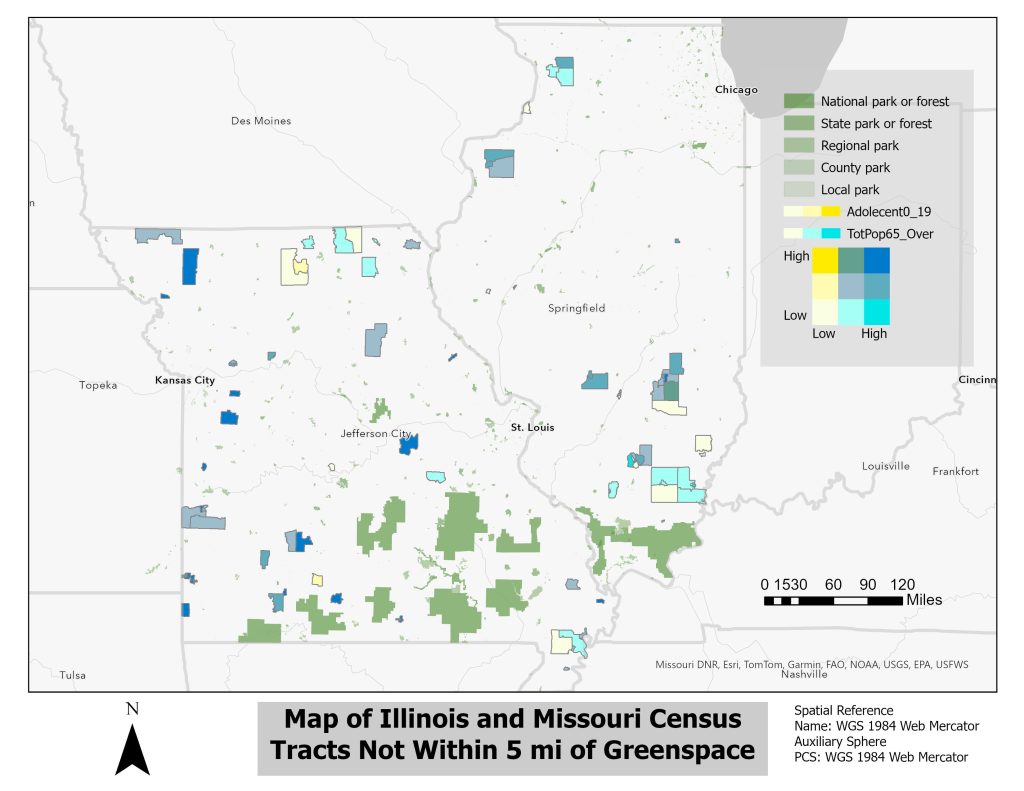
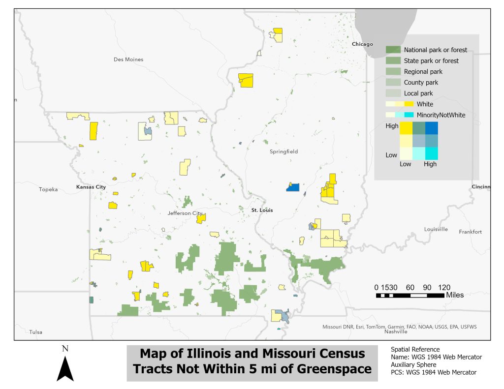
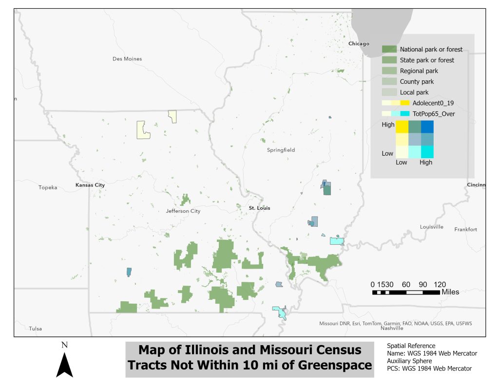
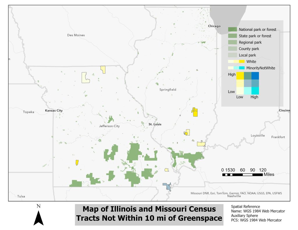
Map of Missouri and Illinois Greenspace (Race and Age-Based Census Tracts)
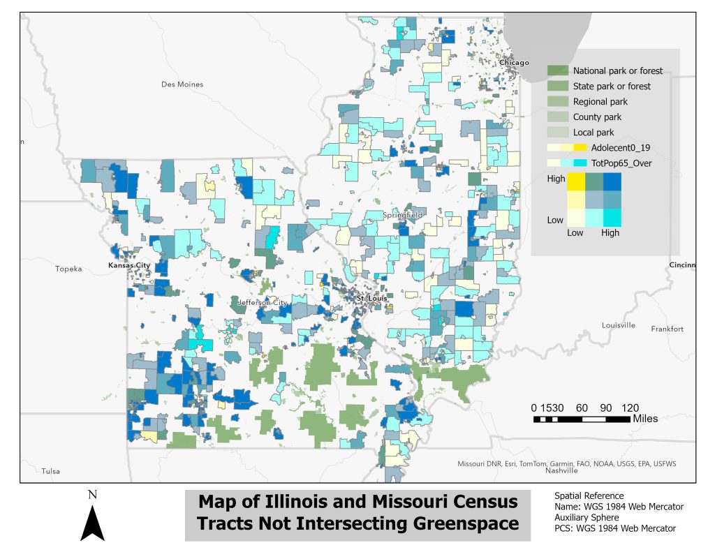
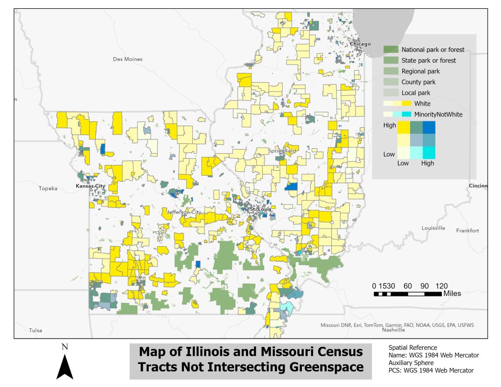
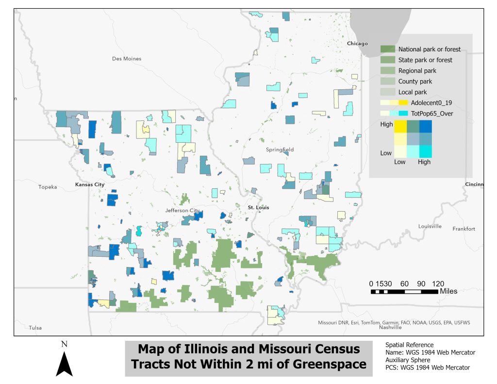
While I initially intended on only identifying Census tracts that lacked access to greenspace I decided that it would be best to demographic census data as well/ I hoped that this would be able to make my work not only more powerful to the viewer but also more impactful if it was presented to an organization advocating for more greenspace.
This part of my project was especially challenging. During the first few days of adding the census data, I had to consistently troubleshoot to figure out why when I joined the two files all the census data was showing as null. I also had to scramble last minute to figure out why after creating a selection layer with an inverted selection all my data was nullified again.
Census Tracts Not Intersecting
Census Tracts Not Within 2 Miles
Census Tracts Not Within 5 Miles
Census Tracts Not Within 10 Miles
What Was Learned
- How to swap selections in ARC GIS Pro
- How to identify essential variables in ARC GIS Pro
- How to calculate new variables in ARC GIS Pro
- How to create a selection based on distance in ARC GIS Pro
Goal 5 Skills for Life-Long Learning (20%)
I will look both inside and outside the classroom to deepen my knowledge of the things that interest me.
URCA Map Of Rockford Illinois
While my map of Rockford Illinois was made for a very different purpose it was an essential part in inspiring how I would make my maps of Illinois and Missouri Greenspace. This map not only taught me how to use ARC GIS Pro but also taught me how to think critically about how I display my data. Therefore, I feel that this map is a perfect example of my commitment to lifelong learning and learning outside of the classroom.
What Was Learned
- How to use ARC GIS Pro
- How to join Datasets in ARC GIS Pro
- How to change symbology in ARC GIS Pro
- How to add elements to an ARC GIS Layout
- How to think critically about the census data I display
