Multi-media Essay 2
Gravois Park: Gravel Roads, Garden Lots, and Gritty Beginnings
You are surrounded by history if you have ever made your way through the center of south St.
Louis’, Gravois Park. The story of land, people, and change, not just of homes and streets. This
is a look at who, what, where, when, and why/how our area came to be. This way, when you
walk by a corner you can realize you’re seeing legacy and history rather than just old bricks.
Who walked here first, and who came next:
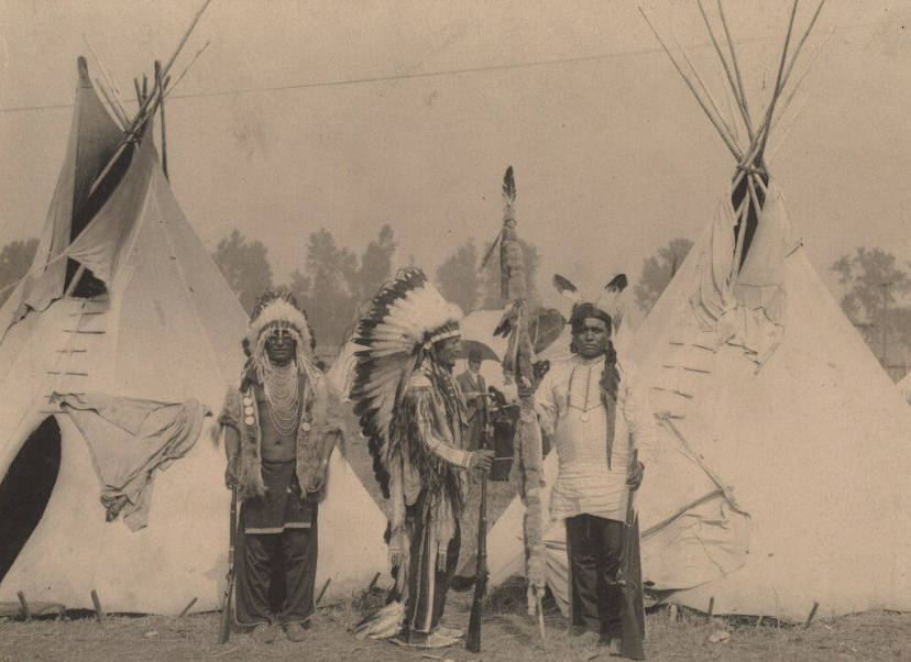
Indigenous peoples lived in the area that would become St. Louis and the surrounding area long
before streetcars, shops, or even the French flag flew over this territory. According to Osage
Cultural History, the Osage Nation and associated Dhegiha-Siouan groups actually “settled in the Cahokia/St. Louis area for the longest period of time.” Their presence serves as a reminder that the land on which this neighborhood is situated had stories and lives long before the city grid.

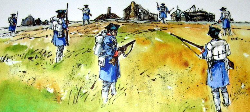
Let’s fast forward to European settlement. French colonists Pierre Laclède and his young lieutenant Auguste Chouteau established the city of St. Louis in 1764 in search of a trading post on the Mississippi (The Founding of St. Louis). American settlers arrived in large numbers following the Louisiana Purchase in 1803, bringing with them new patterns of growth and land use.

The land that would eventually become Gravois Park was on the outskirts of the city and had been changing ownership by the early 1800s. Black people, initially enslaved and later free, assimilated into St. Louis’s developing urban community. It’s important to remember that Black migration was rooted in the early settlement era, even though a large portion of the story takes place in the late 1800s and early 1900s.
What & Where the land we call Gravois Park:
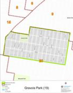
The city states that “the Gravois Park Neighborhood is located in southeast St. Louis and is bounded by Grand Boulevard on the west, Jefferson on the east, Chippewa on the south, and Cherokee on the north” (Neighborhoods, Gravois Park Overview).
The French term “Gravois” refers to the surrounding terrain or creek bed and means something like “gravelly” or “rubbly.” For instance, “gravois” was used to mean “gravel” in Missouri French (Collections, Missouri French Place Names). Additionally, the neighborhood became connected to Gravois Avenue, which was once known as “Gravois Road” and served as a major route from the city to the countryside.
The park that bears the neighborhood’s name is a reminder of its early identity. According to Gravois Park, Parks Division, the park was “one of the original Commons grants of 1812 … Size: 8.20 acres.” This indicates that the city or its forerunners had already planned this land for urban uses by 1812, even though it was sparsely populated.

Why & How it happened:
Why did this area become settled instead of open land?
First of all: the location. The Mississippi River route, close to downtown St. Louis, and the availability of roads such as Gravois Avenue meant it could be easily accessed. “The name ‘Gravois’ is suggestive of its topographic qualities: gravelly creek courses and lands easy to settle (or at least well-known to French settlers) (Missouri French Place Names)
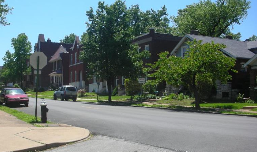
Secondly: growth of population and migration. Growth of the town itself, French settlers, then Americans after the Purchase, then waves of immigration in the 19th century (German, Eastern European) to neighborhoods like Gravois Park in the south side. This is followed by the growth of the town’s-built environment. This is evident in the city site itself: “Reflecting its settlement at the turn of the twentieth century, the neighborhood’s architectural mix includes… Froebel Elementary School, founded in 1895” (Neighborhoods. Gravois Park. Overview.
Third: economic opportunity and infrastructure. With the extension of street rail, transportation routes, and the grid to the south side of the city came the transformation of what had been farmland or common grazing pasture to subdivided real estate. From “Commons” pasture lands that existed in the south of town to erecting a line of homes, transport brought density.
What it means to our neighborhood today
As you walk through the grid of Gravois Park and see a structure dating to 1890 or look at how the grid changes and follow the road that curves on a former path, you see layers of transition: Indigenous to French to American to immigrant town. As you consider the history of
Gravois Park in that “official” park history dates to 1812, it is noteworthy. This is not a place on
the edge of town. It has history, soul and a voice of it’s own.

Closing:
Gravois Park is more than just southwest of downtown. It’s a place where gravelly creek beds give way to fields, fields to lots, and lots to homes. It’s land that shifted hands, from Indigenous peoples to French colonists to American city‐builders, and in doing so reflects the story of
St. Louis.